Show the map
Evaluated Track - ITRA
Sky Erciyes 2017 - Erciyes Trail Run
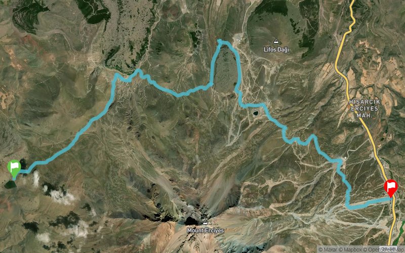


 Kulpak (TR)
 Çomakli (TR)


This trail goes around high plato's, runs higher than 2000mt. Occasionally, the trail runs over eroded lava rock surfaces.
Points of Interest table
| Accum. | Intermediary | |||||||
|---|---|---|---|---|---|---|---|---|
| POI | Description | Alt. | Dist. | D+ | D- | Dist. | D+ | D- |
 Competition organized on 07/08/2017
Trace n°39089
Ascent threshold : 3 m Distance threshold : 30 m Smoothing : Yes Origin of altitudes : MNT Google
Ascent threshold : 3 m Distance threshold : 30 m Smoothing : Yes Origin of altitudes : MNT Google
Crossing
Dominant terrain : Path
Max alti. : 2624 m
Avg alti. : 2326 m
Min alti. : 1998 m
Longest ascent : 620 m
Longest descent : 380 m
Dominant terrain : Path
Max alti. : 2624 m
Avg alti. : 2326 m
Min alti. : 1998 m
Longest ascent : 620 m
Longest descent : 380 m
Elevation profile
More tools
Create a new roadbook page
Map and track on your website
Warning ! When you insert a Trace de Trail map on your website, you agree not to hide any element of the module (links to Trail Trail or Trail Connect banner)
Add a realisation
Validate
Add a realisation to share your chrono and describe the conditions that you encountered during you trail running !
Add a comment
Validate
Show the infos
Add a track


